


Karte raus und einfach warten. Niemals zu früh abbrechen. Was meinst du mit 'USB angeschlossen, keine Reaktion' ?
Beiträge von AndreasL
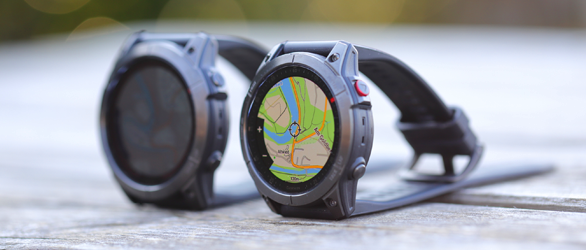
Garmin fenix 7X und epix Gen 2 im Test
Der Schwerpunkt dieses Tests und Vergleichs der Garmin Fenix 7X Solar und Garmin Epix Gen 2 liegt auf den Sensoren wie Höhenmesser, Positionsbestimmung und Herzfrequenz. Was unterscheidet die beiden GPS-Outdoor-Smartwatches? Und wie gut ist die Taschenlampe der Fenix 7X für den Outdoorbereich?
Hier geht es zum Test der Outdoor-Smartwatches ...
-
-
Installieren und selber testen. Ist doch spannend neue Dinge raus zu finden. Besser wie jeder Krimi und zu guter letzt teilst du uns deine Erkenntnisse mit

-
Das verwendete Kartenmaterial hat keinen Einfluss auf die Funktion in Sachen Kacheln. Das Problem ist einzig und alleine die Gesamtgröße. Die darf nicht über 2GB kommen. Du kannst offenbar nun aber Worldmap und Topo D V2 plus vieler weitere ohne Probleme drauf tun (solange du im Größen limit bleibst).
-
MMM, wir halten uns an dich, wenns nicht klappt :p
-
wenn du den Webupdater nicht nehmen willst, dann lade dir das verlinkte file runter und starte es. Es macht das gleiche in grün. Ist halt einfach die manuelle Version und man sieht was passiert. Manche Leute trauen dem Webupdater deswegen nicht weil sie vermuten das der evt das File nicht komplett überträgt und dann die Firmware zerschießt. Das ist natürlich Blödsinn, da das Flashen nicht beginnt wenn der Transfer nicht 100% ok war.
Der Webupdater ist reine PC Anwender einfacher zu handhaben.
Es liegt einfach an dir, welche Version du bevorzugst. Traust du keiner, dann behalte deine Version oder lasse das Gerät von einem Fachmann auf den neuesten stad bringen. Man muss nicht jedes Update mitmachen wenn man nicht will.
-
Was hindert dich, den Webupdater einfach auszuprobieren? Hier im Board werden immer nur die direkt Downloads verlinkt da viele Benutzer dem Webupdater nicht vertrauen und gerne selber die Kontrolle behalten.
-
Gibt kein Grund, warum das Update nicht gehen sollte. Die sind nicht kummulativ und setzen nicht bestimmte Versionen voraus. Aber ein Problem hast du. Ein zurück auf V3.7 geht nicht, da nicht per Download verfügbar.
Der Update sollte auch unter Windows Vista gehen, wenn nicht, kannst du es als Warnung an alle hier schreiben

-
Lösche am besten vorher alle gespeicherten Routen und Wegpunkte und probiere es noch einmal. Das diese Meldung kommt zeigt, das Garmin offenbar nicht am Speichermodell für routen geändert hat sondern nur die Optionen und Straßenbewertungen geändert hat.
-
Garmin ändert meist sehr viel mehr und schreibt kaum was ins Change Log. Siehe das aktuelle Zumo Release. Dort ist wohl das lang ersehnte Autobahn vermeiden Problem gelöst worden und es erscheint nicht im Log. Dafür aber irgendwelche Anpassungen an afrikanische Zeitzonen.
-
-

und wo bleibt das Update für den Zumo 550?
Na, dann guck doch mal genauer hin
ist doch alles da. Für beide Geräte oben sticky Threads mit Links zu der Firmware.
ein Weihnachtsmärchen wird wahr - Autobahn vermeiden funzt
Wär ja doll .. und ich krieg Chips vom Andreas W.

Warum schreibt Garmin sowas nicht ins Changelog? -
Salt & Vinegar oder Marmite?
SCNR -
Es mag evt noch andere Lösungen geben, warten wir mal auf die anderen Mitglieder ob sie eine Idee haben. Meine sind alle komplett per Hand gestrickt, wobei die Thumbnails automatisch von meiner Galerie erzeugt werden. Ich brauch nur den Link kopieren und die HTML Tag zu setzen. Bin damit aber auch noch nicht überall durch, weils, wie du schon gemerkt hast, viel Arbeit ist. Aber die Winterabende sind lang
-
auch hier beim 500'er: keinen Hinweis auf Änderungen am Autobahnrouting. Ob sich da was getan hat, muss der Test zeigen.
-
-
Change History:
Changes made from version 3.30 to 3.80:- Add support for African Time zones.
- Add support for several new pre-recorded voices.
- Add support for distances in yards when a British voice is selected (may require updated voice).
- Added support for MAD Maps scenic routes.
- Allow the compass page to display 5 digits of elevation.
- Improved handling of circular routes. Allows entry at alternate point. Will not announce arrival when starting a route. (All routes will be deleted after update, but can be re-imported from GPX files.)
- Keep the map detail level when go from main map to browse map.
- When reviewing a gas station after pressing the fuel button from main map, the map will now be centered on selected gas station rather than the vehicle.
- Change Optimal Reorder so it does not include the final point when reordering.
- Correct issue where backlight may change if you remain on the backlight adjust page for a period of time.
- Correct issue where backlight may turn off when location is above polar circle.
- Correct issue that would sometimes cause highways to be labeled with the incorrect name.
- Correct issue that would not allow more than a single point to be added to some routes.
- Correct issues when the same map is loaded in two different regions.
- Correct issue when searching for cities on basemap.
- Correct off road transitions in track to route when there is no map coverage.
- Correct issue playing Audible format 4 books.
- Correct distance for mixed routes imported from MapSource
- Correct issue that caused all traffic delays to be 1min when using certain maps.
- Correct issue that prevented TrafficMaster service from being properly named on the unit.
- Correct issue that prevented some very large track log activities from being archived correctly.
- Correct issue where changes to a route would be lost if you press and hold the back button.
- Correct issue that caused MP3's to be paused for navigation announcements when navigation was set to off and a pre-recorded voice was selected.
Link: http://www8.garmin.com/support/download_details.jsp?id=1909
-
Ich mach mal dicht, das haben wir auch im Firmware-Board. Sonst wird's doppelt. Vielen Dank für den schnellen Hinweis!
Hier gehts weiter:Zümo 500: http://www.naviboard.de/vb/showthread.php?t=24394
Zümo 550: http://www.naviboard.de/vb/showthread.php?t=24393Im Prinzip bei beiden die gleichen Änderungen.
PS: es scheint möglicherweise Probleme mit den Downloadlinks in den Threads zu geben. Wer nicht zur V3.80 kommt, möge mir bitte eine PM schreiben, ich versuch grade rauszukriegen, warum das so ist.
-
und um der Frage gleich vorzubeugen: Laut Beschreibung keine Änderung am Autobahn-'Problem'.
Die Version 3.70 taucht im Changelog nicht auf. Es ist ein direkter Sprung von 3.30 auf 3.80
-
Change History:
Changes made from version 3.30 to 3.80:
- Add support for African Time zones.
- Add support for several new pre-recorded voices.
- Add support for distances in yards when a British voice is selected (may require updated voice).
- Added support for MAD Maps scenic routes.
- Allow the compass page to display 5 digits of elevation.
- Improved handling of circular routes. Allows entry at alternate point. Will not announce arrival when starting a route. (All routes will be deleted after update, but can be re-imported from GPX files.)
- Keep the map detail level when go from main map to browse map.
- When reviewing a gas station after pressing the fuel button from main map, the map will now be centered on selected gas station rather than the vehicle.
- Change Optimal Reorder so it does not include the final point when reordering.
- Correct issue where backlight may change if you remain on the backlight adjust page for a period of time.
- Correct issue where backlight may turn off when location is above polar circle.
- Correct issue that would sometimes cause highways to be labeled with the incorrect name.
- Correct issue that would not allow more than a single point to be added to some routes.
- Correct issues when the same map is loaded in two different regions.
- Correct issue when searching for cities on basemap.
- Correct off road transitions in track to route when there is no map coverage.
- Correct issue playing Audible format 4 books.
- Correct distance for mixed routes imported from MapSource
- Correct issue that caused all traffic delays to be 1min when using certain maps.
- Correct issue that prevented TrafficMaster service from being properly named on the unit.
- Correct issue that prevented some very large track log activities from being archived correctly.
- Correct issue where changes to a route would be lost if you press and hold the back button.
- Correct issue that caused MP3's to be paused for navigation announcements when navigation was set to off and a pre-recorded voice was selected.
Link: http://www8.garmin.com/support/download_details.jsp?id=1907
-
lade dir gta4.net runter. Das hat unser Blackwilli erstellt. Das kml File kannst du einfach mit dem Beispielcode von GM einbinden:
Code
Alles anzeigen<script src="http://maps.google.com/maps?file=api&v=2.x&key=hier_deinen_API_Key_eintragen" type="text/javascript"></script> <script type="text/javascript"> //<![CDATA[ function load() { if (GBrowserIsCompatible()) { var map = new GMap2(document.getElementById('map')); map.addControl(new GLargeMapControl()); map.addControl(new GHierarchicalMapTypeControl()); map.addMapType(G_PHYSICAL_MAP); map.setCenter(new GLatLng( 52.10000, 13.80000), 8); map.setMapType(G_PHYSICAL_MAP); var gx = new GGeoXml('http://www.url.tld/file.kml'); map.addOverlay(gx); } } //]]> </script> <div align="center"> <div id="map" style="width: 640px; height: 480px"></div> </div>Die Bilder musst du dann ins Web kopieren und den Pfad in der kml Datei anpassen. Beispiel wie es dann aussieht:
http://www.biker-reise.de/brandenburg/tour10.php
Die Koordinaten in (new GLatLng( 52.10000, 13.80000), 8); legen den Startpunkt fest, die 8 ist die Zoomstufe.Alternativ kannst du dir das hier mal ansehen:
http://www.gpsvisualizer.com/Den Code von denen kannst du einfach in ein iframe einbinden. Beipiel:
http://www.biker-reise.de/brandenburg/ausflugsziele.phpDie Bilder in den Sprechblasen kanst du einfach per img tag in description der kml files reintun. Es gibt sicher auch andere Methoden.